
TIN Surfaces from LandXML files are basically ready to use. They are made up of a series 3-dimensional points (Easting, Northing and Elevation) followed by an ordered collection of the 3-D points which describes triangles or faces.
![]()
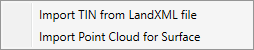
Choose Import TIN from Land XML file from the sub-menu of the Tin Surface button. Next, browse to the .XML file which contains your TIN Surface and click [Open]. Channel Studio will parse the file searching for available Surface elements.
Afterwords, you’ll be presented with the following screen:

Here you can select a single Surface TIN from the drop-down list box. (You can only add one surface). Click the [Import] button. A message box will first appear informing you of the number of points and triangular faces contained in the file.
Click [Ok] and in a few seconds the TIN will be displayed on your Model tab as shown in the example below.

As you move your mouse across the map the elevation is displayed on the status bar
Use your mouse wheel to zoom in/out. Drag to pan.
See Working With a Tin Surface for further discussion.