
Weirs sections are added just like any other channel section. Just click on the Weir Section button on the side tool bar on the Model tab. Then move your mouse to the desired river station and click your mouse. Click the [Ok/Select] button or press [Esc] when finished.
![]()
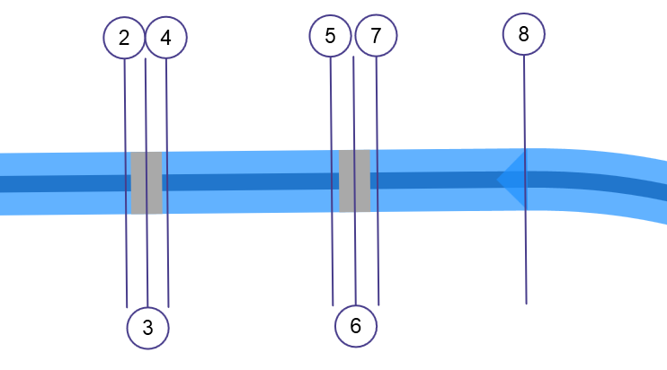
A typical Model layout with Inline Weir sections will look like this:
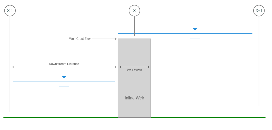
Weir Section Data
It’s important to note that bridge, culvert and inline weir sections do not require geometric (Station, Elevation) data. Rather they inherit the data from the previous downstream section. For example, in the model shown above, Weir Section 3’s geometric data will be bound to Section 2, and Weir Section 6 will be bound to Section 5.
All that’s needed are inputs pertinent to the structure itself which are described below.
Name
Optional but it is a recommended input.
Downstream Distance
Enter the distance from the downstream channel section to the downstream edge of the weir structure.
Weir Structure
Weir Width
Enter the width of the weir structure in the flow direction.
Weir Crest Elevation
Enter the elevation of the top of the weir. This elevation will be used to trigger overtopping flow. The distance between where this elevation intersects the channel banks is what is used as the weir crest length during weir flow calculations.
Apply Your Data
To accept your inputs, click [Apply].